Professor Yu Zhaoyuan made a report on "Quantum Simulation Model Study of Highway Traffic Flow" at Zhangzhou College


1. Introduction to the report

From October 24th to October 25th, 2020, Professor Yu Zhaoyuan participated in an academic seminar on geographic information perception and service organized by the Institute of Geographic Information and Tourism of Zhangzhou College, and gave an academic report entitled “Quantum Simulation Model Study of Highway Traffic Flow”. Based on the problems existing in the classical traffic flow simulation model, the paper introduces the cause of the study of quantum traffic simulation model, puts forward the highway traffic flow simulation model based on quantum resonants and quantum random walk, constructs the non-observable human social process dynamic simulation method based on quantum random travel, and realizes the accurate simulation and scenario prediction of near-individual particle degree intercity highway traffic flow. Read More

Associate Professor Rowan attended and reported to ENGAGE workshop at the CGI 2020 conference

On 20 October 2020, Associate Professor Rowan joined other teachers and some graduate students in the ENGAGE at workshop at CGI 2020 conference and gave an academic presentation entitled “Geometric algebra-base multilevel declassification method for geographical field data”, The report discusses the need for multi-layered GIS data decryption due to the diversity of GIS application patterns, for example, the need to decrypt publicly used data to hide confidential spatial information, the common arrangement of data that is not a regular encryption method, and the need to preserve general geospatial characteristics of the restored data. In addition, different levels of restore are required when faced with different levels of confidentiality.The report describes the use of geometric algebra (GA) to achieve a controlled method of precision decryption and restoration. The geographic field is represented as a GA object and further implements a uniform represent of the field. Read More

Professor Yu Zhaoyuan attended the 2020 Geographic Information Technology Innovation Conference and made relevant reports

The 2020 Geographic Information Technology Innovation Conference, held in Beijing from October 13-16, 2020, was jointly organized by the China Geographical Information Industry Association, the China Surveying and Mapping Society, the China Regional Science Association, the China Mayors Association, the School of Earth and Space Sciences of Peking University, the School of Resource and Environmental Sciences of Wuhan University, Yi Zhirui Information Technology Co., Ltd. Pay attention to the typical and innovative application of geographic information technology by users in various industries. The conference will bring together scholars, experts, enterprises, education and other forces in the field of geographic information to explore the innovative value of geographic information technology in promoting information exchange and information management in the human world. Professor Yu Zhaoyuan reports online, which explores the theoretical methods, key technologies and typical applications of the urban information model (CIM) based on holographic map technology, starting from the concept and connotation of the urban information model. Read More

Professor Yuan Linwang participated in the 255th Shuangqing Forum and gave a special report on “Digital Twins and Virtual Experiments for Multi-scale Modeling of Land-Sea Interfaces”

From September 10 to 11, 2020, the 255th Shuangqing Forum of the National Natural Science Foundation of China (NSC) was held in Beijing. Professor Yuan Linwang participated in the forum and made a special report on “Digital Twins and Virtual Experiments for Multi-Scale Modeling of Land and Sea Interfaces”, which reads: Digital Twin and Virtual Experimental Technology establishes digital mapping of the real world and its features, processes and mechanisms by integrating all kinds of observation data and model patterns under a unified space-time framework, and using virtual simulation and other means. The sustainable development of coastal zone involves the interaction of multi-layer, multi-domain and multi-scale elements, the development of digital twin technology and virtual experimental method of multi-scale modeling of land-sea interface, the convergence of multi-domain and multi-scale space-time data under the unified space-time framework, the integrated modeling and big data intelligent analysis of multi-pattern coupling across the circle layer, and the provision of virtual twin coastal multi-modal fusion expression and multi-scenario virtual experiment with real perception and feedback control. Read More

Professor Yuan Linwang and His Students Attended the Annual Meeting of the Chinese Geographic Society (East China) in 2019

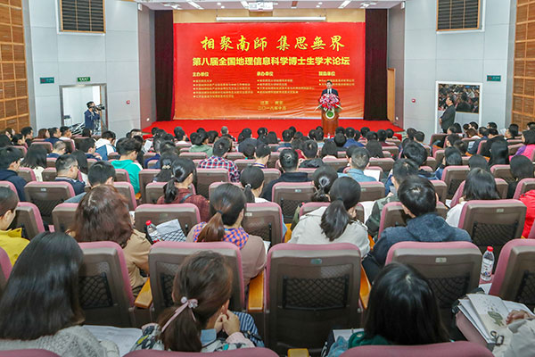
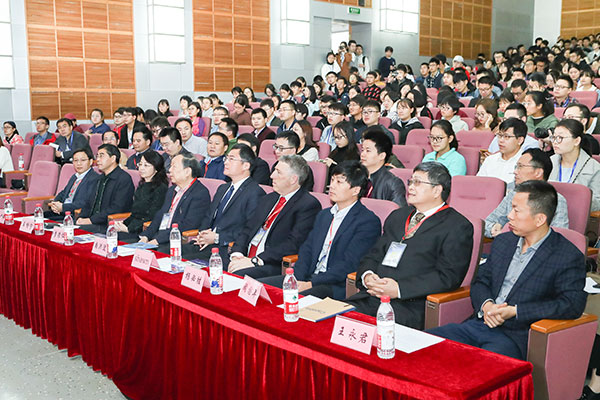
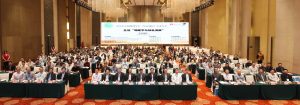
From May 2 to 4, 2019, the annual meeting of the Chinese Geographic Society (East China) in 2019 was held in Ningbo, sponsored by the Chinese Geographic Society. With the theme of “Geography and Green Development”, the conference invited the academicians of Xiajun College of Wuhan University, Professor Jiang Guojun of Zhejiang Normal University, Professor Lu Huayu of Nanjing University, Professor Yang Xiaoping of Zhejiang University, Professor Liu Min of East China Normal University, Professor Yuan Linwang of Nanjing Normal University, Professor Chen Xing of Institute of Geographic Science and Resources of Chinese Academy of Sciences and other famous experts and scholars from China to Meeting.The conference attracted more than 1000 delegates from universities, scientific research institutes and relevant departments of geography, exchanged frontier theories and research hotspots in the field of geography, shared new trends in academic research and major needs of national macro-decision-making, and provided practical basis for the green development of geography.

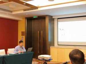
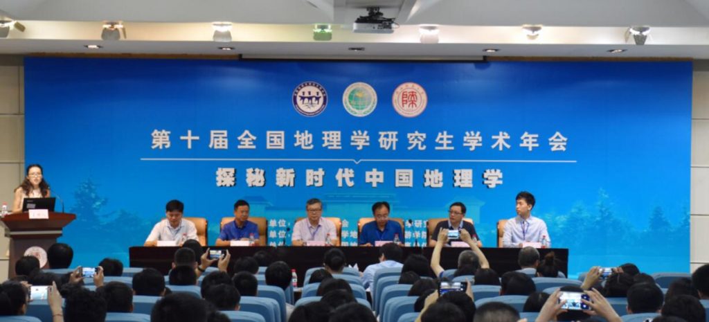
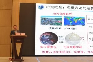
Professor Yuan Linwang and his doctoral students Gao Hong, Zhou Xinxin and several graduate students jointly attended the meeting. On May 2, Professor Yuan Linwang, as an invited guest, gave a report entitled “The Theory and Method of Scene GIS Construction”, introducing the theoretical research of Scene GIS from the aspects of the subject ownership of Geographic Information Science and the demand of social services, and planning and thinking about the future of Scene GIS.

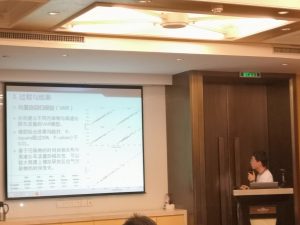
Following the invitation, 12 parallel conference sessions with different themes were set up. On the afternoon of May 3, Dr. Zhou Xinxin presented a report on “the Accessibility of Comprehensive Urban Service Facilities based on Multiple Modes of Transportation” at the Theme Conference of “High-quality Integration and Urban Agglomeration Development in the Yangtze River Delta”. On the morning of May 4, Dr. Gao Hong gave a report on “Pulse Response of Vehicle Flow to Air Pollution on Ring-shaped Expressway in Coastal Cities” at the Theme Conference of “Resources, Environment and Sustainable Development in the Eastern Coastal Region”. Both reports were widely concerned and discussed by experts, scholars and students.

Professor Yuan, Linwang attends the National Academic Forum of PhD students in Geographic information science and reports on the theme of the conference

October 26, 2018 28th, the third National Geographic Information Science Doctoral Academic Forum was held at the XianLin campus of Nanjing Normal University.Professor Yuan, Linwang attended the opening ceremony and made a thematic report entitled “GIS Innovative thinking: Thinking from a mathematical perspective” at the meeting.

Professor Yuan visits the University of Maryland in the United States to make an academic report

October 10, 2018 Professor Yuan and the College delegation visited the University of Maryland, where he met with teachers and students involved in the Mpsgis project, discussed the current status of the project, discussed feedback from teachers and students, and exchanged views on future educational and research cooperation between NNU and UMD. In the second half of the meeting, Professor Yuan gave a seminar entitled “The Future of GIS” for the participating teachers and students, focusing on the exploration and research work made by the Geometric Algebra Project group in the future GIS direction.  

Associate Professor Yu attends ESRI China User Conference and makes a presentation

September 18, 2018-19th associate Professor Yu was invited to Beijing for the 16th session of the ESRI China User Conference in 2018, at which a report entitled “Innovative GIS” was made.The report analyzes the direction of the development of innovative GIS from the perspective of subject development, time demand and national strategic needs, and reports to the participating experts on the relevant work of the project team in GIS research based on geometric algebra.The participating experts made a high evaluation of the work of the project team and discussed the related technical issues in depth.  

Associate Professor Yu Zhaoyuan participated in the Geography conference and made a report of the meeting

August 2018 29-30th, associate Professor Yu Zhaoyuan participated in the 2018 China Geography conference hosted by the China Geographical Society, Shaanxi Normal University and the Institute of Geography Science and tourism.And in the Chapter field: “Geographic information science-the creative perspective of the young people’s geography” made a report entitled “From static depiction to dynamic construction: The holographic image and feature diagnosis of geographic information”.

Professor Lin Wang participated in "The annual National Geographic Graduate Conference" and made a keynote report.

August 2018 29-30th, hosted by the Chinese Geographic Society, the 2018 China Geographical Congress hosted by the College of Geography Science and Tourism of Shaanxi Normal University held in Xian, as an important part of this Conference, The annual National Geographic Graduate Academic conference was held in Shaanxi Normal University (Yanta campus) in August 27-28th.The conference takes the theme of "The development of Chinese geography in the new Era" and summarizes and exchanges the latest research results in recent years on the topic of geography theory, method and technology application. Professor Lin Wang was invited to attend the National Geographic Postgraduate Academic Annual conference and to make a keynote report on the topic: "Mathematical Thinking and Geography research".